Humanitarians are increasingly recognising the challenges of responding to disasters in urban areas by hiring urban-focused staff, developing urban-tested tools and advocating for urban-specific policies within their own organisations and in the sector as a whole. Attention is shifting from ‘what makes urban different?’ to ‘what can we do about it?’ and ‘how can we improve what we know?’.
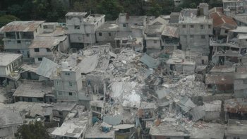
While the 2010 Haiti Earthquake was by no means the first urban disaster, the focus on urban disasters has intensified in the last five years. The Haiti response shone a spotlight on the huge gaps in understanding the humanitarian community had about urban humanitarian response. While humanitarians in this respect are new to the urban debate, there is a whole other world of urban planners, designers, climate and development actors who have been working in and studying urban environments long before this.
Urban areas are full of complex systems both physically (infrastructure, sewage, transport links) and socially (interactions between faith groups, community associations, youth clubs, etc.) as well as in terms of governance (levels of government, number of stakeholders).

Photo credit: Flickr/ EC DG Echo
While these systems each pose their own challenges for humanitarian response, they are also full of potential. Cities may have better access to resources, have people to mobilise and may receive more widespread attention in times of crisis. Key to taking advantage of these urban advantages is understanding these systems both before, during and after a disaster.
Tools such as mapping are increasingly used by humanitarians to understand the urban environment, and are just one example of how urban planning can improve humanitarian response. Mapping can be done in the preparedness phase to pinpoint hazards as well as existing infrastructure and services, in an emergency response to identify where people have been displaced and what infrastructure has been affected, and in recovery planning to identify which areas are safe to return to and where aid is focused. Mapping can be used to understand social systems, stakeholders and networks, and can also help to improve coordination and reduce gaps in coverage. For more on how humanitarians can use mapping to understand urban environments, register for ALNAP's webinar Who, What, When, Where: Mapping for Urban Humanitarian Response (link missing) on 24 July.
In May of this year, over 150 humanitarians, urban planners, academics, architects and designers met at the first Design for Urban Disaster Conference hosted by Harvard University, Oxford Brookes University, Habitat for Humanity and IFRC. The conference, organised around themes of response, resilience and transformation, sought to bring humanitarians and urban design professionals together to consider how these disciplines can better work together to prepare and respond more effectively to future disasters.
The conference sessions touched on a wide variety of topics, from using drones in humanitarian response to design of post-disaster shelter and the ethics of crisis mapping. Overwhelmingly there was recognition of the mutual benefits for both humanitarians and the urban design community in working together, as well as recognition that often these two communities are speaking different languages. Reflecting on the conference, IRC’s Kellie Leeson noted that designers are often looking at spatial systems while humanitarians at communities and individuals. In an ALNAP webinar (link missing) in August 2013, architect Alison Killing noted that humanitarians look at livelihoods, shelter and networks in urban areas where designers focus on the built environment. For more resources on urban design/planning relevant to humanitarian response, visit the Urban Humanitarian Response Portal (link missing).
Reflecting on the DFUD conference, one question going forward seems to be, how can we work better together? Discussions and presentations during the conference suggest we as humanitarians and urban planners/designers need to do the following:
- Recognise the language we use and be specific about what we need from one another: urban designers and humanitarians look at a city differently, which is advantageous only if acknowledged from the beginning.
- Understand the advantages of working across disciplines: working with urban designers can improve coordination and links across sectors and communities.
- Take a more holistic approach when incorporating urban planning/design into humanitarian response. Urban design isn’t used to its full potential if only considered in a sub-working group.
- Work better with development colleagues: urban planning means considering land and the politics around its use, as well as recognising that the work humanitarians do sets the stage for what will happen down the line.
- Document examples of where humanitarians have worked effectively with urban designers, including the challenges faced and how these were addressed.
Questions for thought
- What information do humanitarians need to be able to work effectively with urban planners?
- How can the architecture of humanitarian aid adjust to allow inputs from urban designers at all stages and levels?
- How has your organisation incorporated urban design into urban humanitarian response?