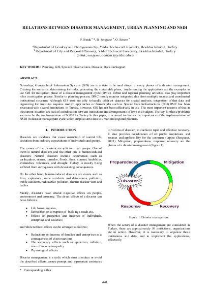
Nowadays, Geographical Information Systems (GIS) are in a state to be used almost in every phases of a disaster management. Creating the scenarios, determining the risks, generating the sustainable plans, implementing the applications are the examples to use GIS for mitigation phase of a disaster management cycle (DMC). Urban and regional planning activities also play important roles in mitigation phases. Similar to planning process, DMC mostly requires integrated data from multiple sources and coordinated institutional structure. Although GIS tools are able to handle different datasets for spatial analysis; integration of that data and organizing the institutes requires modern approaches or frameworks such as Spatial Data Infrastructures (SDI).DMC has been structured with several institutions in Turkey, however, GIS has not been effectively in use. The most important reasons of that in the current situation are lack of coordination between institutions and arrangements of laws and budgets. The key for those problems seems to be the implementation of NSDI for Turkey.In this paper, it is aimed to discuss the importance of the implementation of NSDI in disaster management cycle which supplies core data to urban and regional planners.
Resource collections
- UN Habitat - Urban Response Collection
- Urban Response - Urban Crisis Preparedness and Risk Reduction
- Urban Response Collection - Community Engagement and Social Cohesion
- Urban Response Collection - Economic Recovery
- Urban Response Collection - Environment and Climate Change
- Urban Response Collection - Housing, Land and Property
- Urban Response Collection - Urban Crisis Response, Recovery and Reconstruction
- Urban Response Collection - Urban Resilience